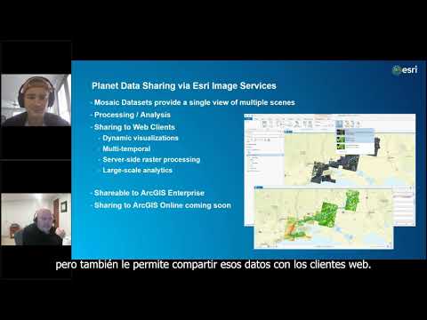
Want to access high-resolution Planet imagery right inside ArcGIS Pro? This short video walks you through how to: ✅ Install the Planet add-in ✅ Sign in with your credentials ✅ Explore and use Planet basemaps (weekly, monthly, or quarterly) ✅ Search, inspect, and order the imagery you need Whether you're monitoring environmental change, supporting urban planning, or managing resources, this workflow will help you get started fast. 📌 Don’t forget to like, share, and subscribe for more ArcGIS tips! #ArcGISPro #RemoteSensing #GIS #Esri #EarthObservation #Geospatial
- 308Просмотров
- 4 месяца назадОпубликованоEsri Eastern Africa
Work with High-Resolution Planet Imagery in ArcGIS Pro | Quick Tutorial
Похожее видео


Популярное
Новини